Mullaghmore Traverse: Red Route in the Burren NP

Mullaghmore Traverse is the longest trail in the Burren National Park. Winding over the park’s most iconic landmark (Mullaghmore) and descending on its other side, it is one not to be missed!
Distance + Time needed:
The walk is linear and one way measures 6km. Realistically you will be returning the way you came, so calculate the distance to be 12km and factor in 2-4 hours to complete the walk.
Difficulty:
Moderate to Hard.
You will be ascending to Mullaghmore’s hilltop and descending on the other side and doing the reverse again. So it does get the heart pumping for sure!
How to get there (parking):
All the walks to Mullghmore have their trailhead at Gortlecka Crossroad. You can park your car here on the Green Road. This parking location gets especially busy at midday and during the summer months so parking might be tricky.
Many people also park along the road here, en route to the turn-off to Mullaghmore. If you are lucky, you can find a space here too.
The Burren National Park has a free shuttle bus running daily between May and August. This bus runs from the Information Point in Corofin to Gortlecka Crossroads. The route is being extended to more locations from May 2025 and the new timetable will be released soon. More information can be found here.

Getting on the walk:
Starting point is Gortlecka Crossroads. You will see coloured disks on the walls next to the road. Follow the red discs to get onto the Mullghmore Traverse Trail. You will be walking on the tarred road for about a kilometre, before the trail winds to the left and off-road towards Mullaghmore.

Follow the red discs for the Mullaghmore Traverse Route.
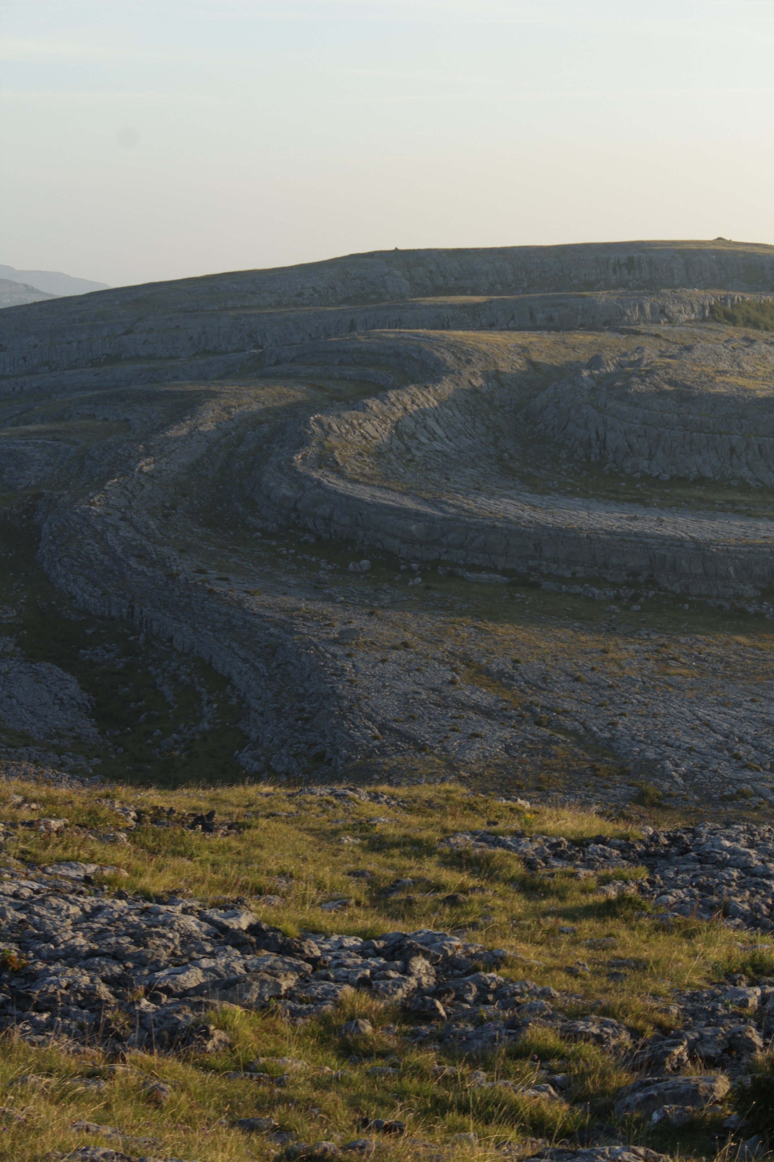
What to expect from the walk:
The trail is mainly on limestone, which can get slippery when it has rained; hiking boots or shoes with traction are advised. There are also more loose stones on this trail than others in the Burren, so mind your ankles.
You will be on the same route as the Blue Trail (Mullaghmore Loop) and the Green Trail (Mullaghmore Return) until you get to the hilltop. From here you will descend and very soon veer right, in the opposite direction to the Blue Trail.
The path is downhill from here and ends at a gate at the bottom of Mullaghmore. If you are returning the way you came, you will have to climb all the way back onto Mullaghmore and descend again on the other side.
It is a long, but very rewarding walk.
Public toilets:
There are no public toilets on this route.


The video below shows the beauty of the limestone landscape in the Burren National Park.